CLOSED PATH
The Mulberry Path is CLOSED due to ground excavation works in the first part of the descent of the Path, therefore the route is no longer visible and has very dangerous ruts.
This path is so called due to the presence, once very numerous, of mulberry trees, native trees with the characteristic white or purple blackberries.
Mulberries are considered the historical memory of a subsistence activity once widespread among the peasant families of the Roero: the breeding of silkworms, made possible thanks to the mulberry leaves, which were collected and used as food for growing bugs.
The mulberry was also used as a "termi" (border) between the lands, as a shade for draft animals (which were tied to the tree) and for the peasants to rest. Thanks to its root system, it was used in steep areas and near ditches for the hydrogeological settlement of lands at risk of landslides.
Today these plants are much less numerous than in the past, but for years they have been protected thanks to the project "Adopt a mulberry", conceived by the Museum of Arts and Crafts of Cisterna d'Asti and aimed at census and restocking of mulberries, to recreate part of the ancient agricultural landscape.
The project involved numerous schools in the Roero area and some owners of plots on the Sentiero dei Gelsi.
ITINERARY
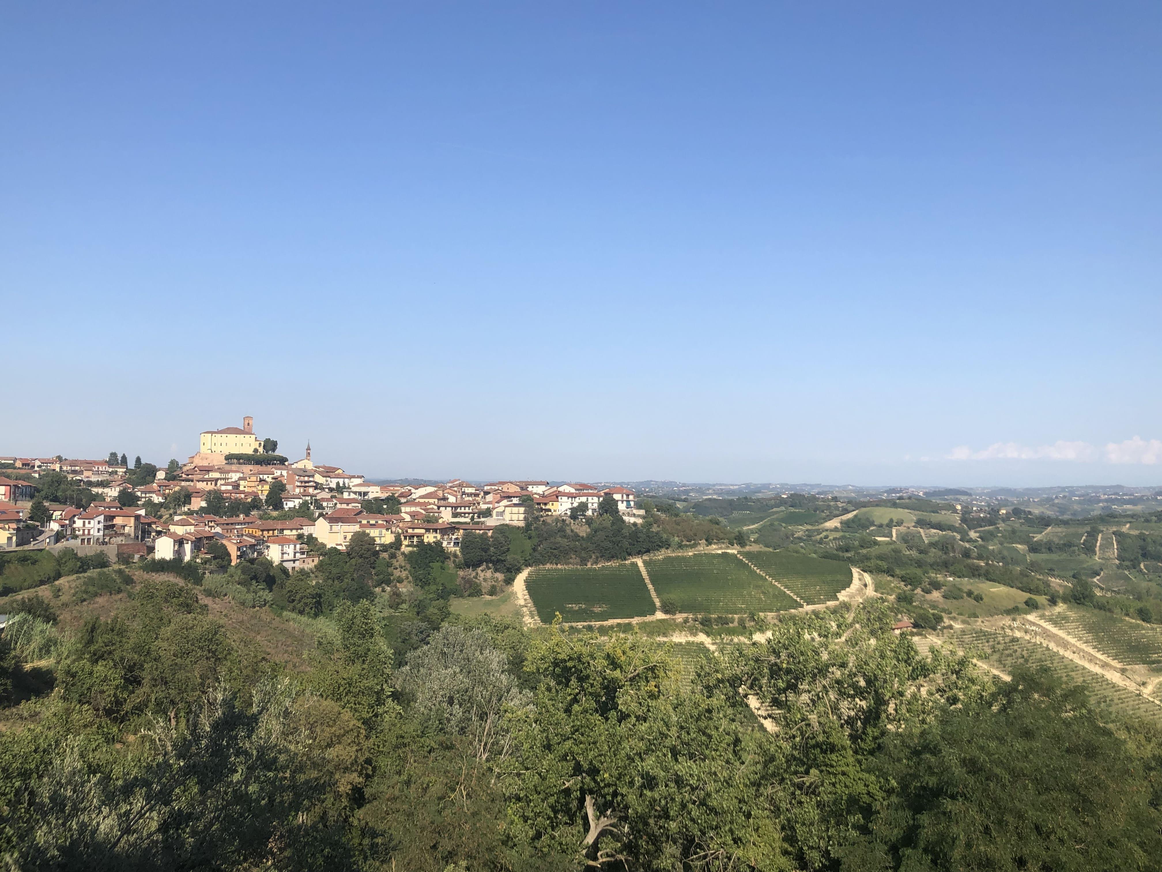
To start the Sentiero dei Gelsi it is possible to park the car in Piazza Rino Rossino and proceed on foot in the historic center of the town, taking via Duca d'Aosta in the direction of Canale and continuing on the paved road between the houses, which becomes Via Italia, skirting a iron fence with a fine view of the cultivated valley below. Shortly before the end of the fence, take the descent that bends to the left: flanking some houses, after a few meters the road becomes a dirt road, and descends into the valley, among fruit trees, hazelnut trees, and a couple of small country huts along the path.
The path with a small zigzag reaches the valley floor, where it proceeds straight between large plots of vineyards on the left, and cultivated fields on the right.
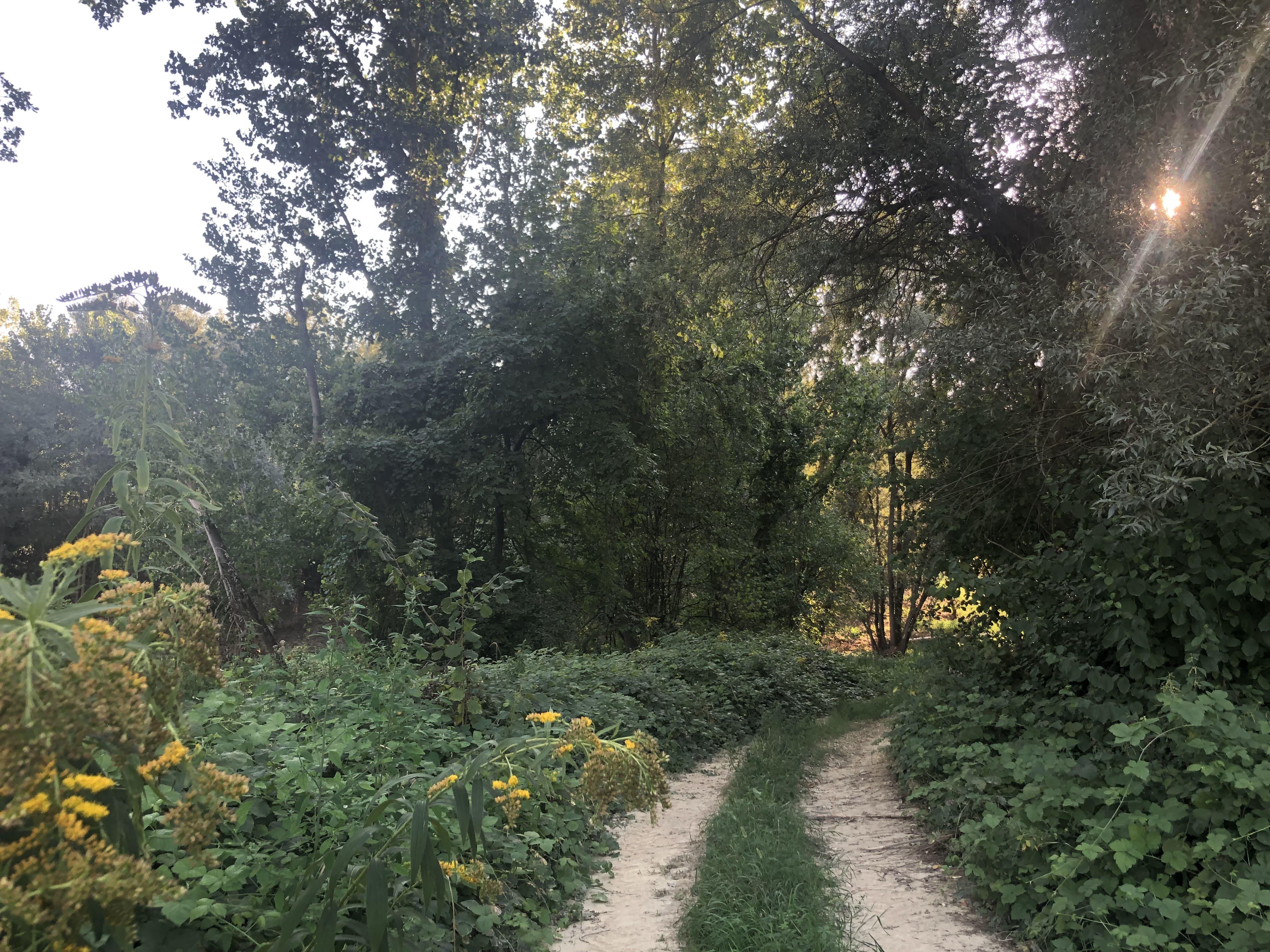
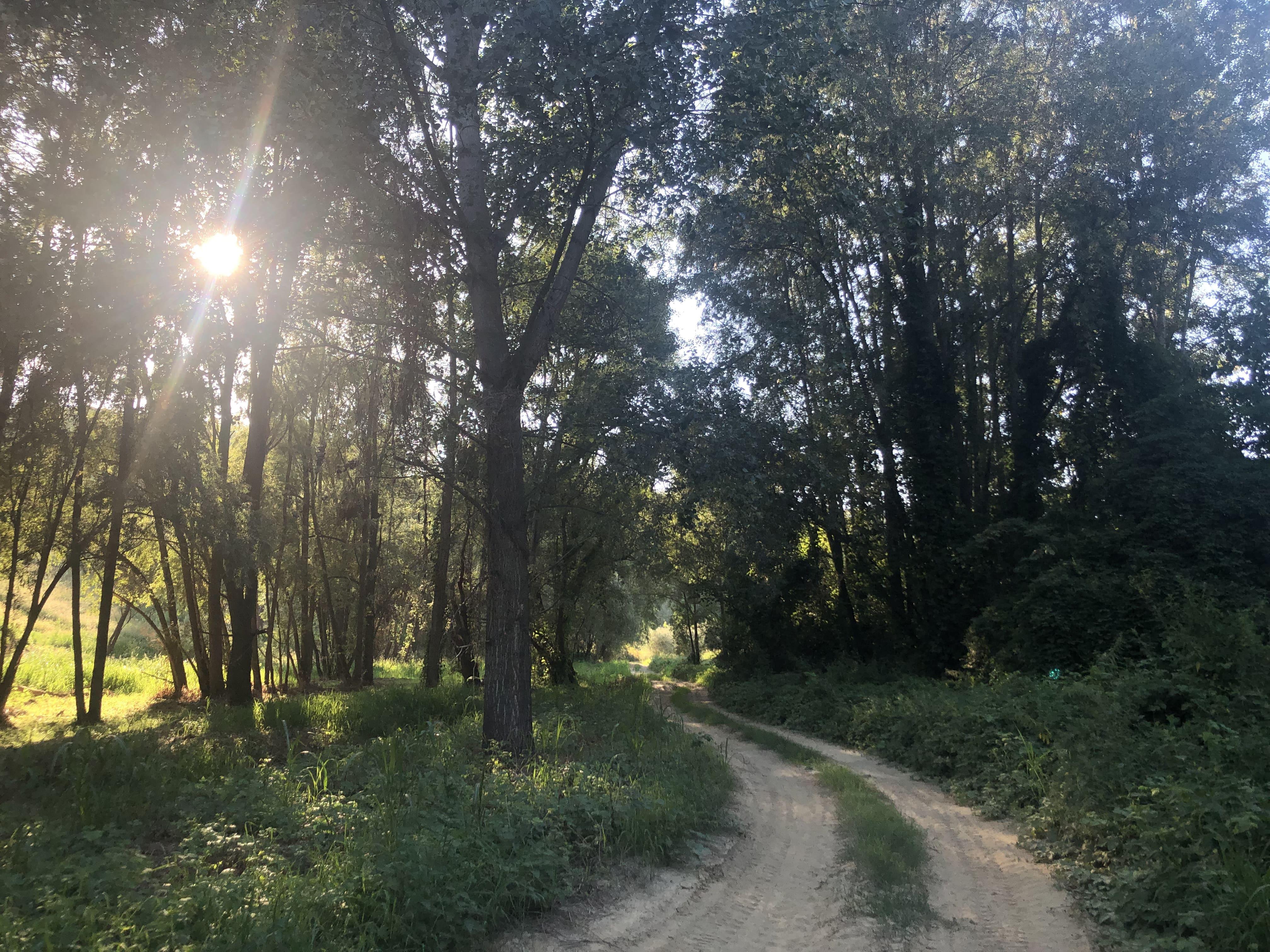
Continuing in the valley floor, the Sentiero dei Gelsi becomes shaded by a stretch of wood: at the first crossroads, turn right, continuing to walk among tall trunks of birches and poplars, sometimes knotted by ivy and other creepers; you immerse yourself in the shade of the fronds, from which the sun's rays filter, creating a natural effect of light and shadow.
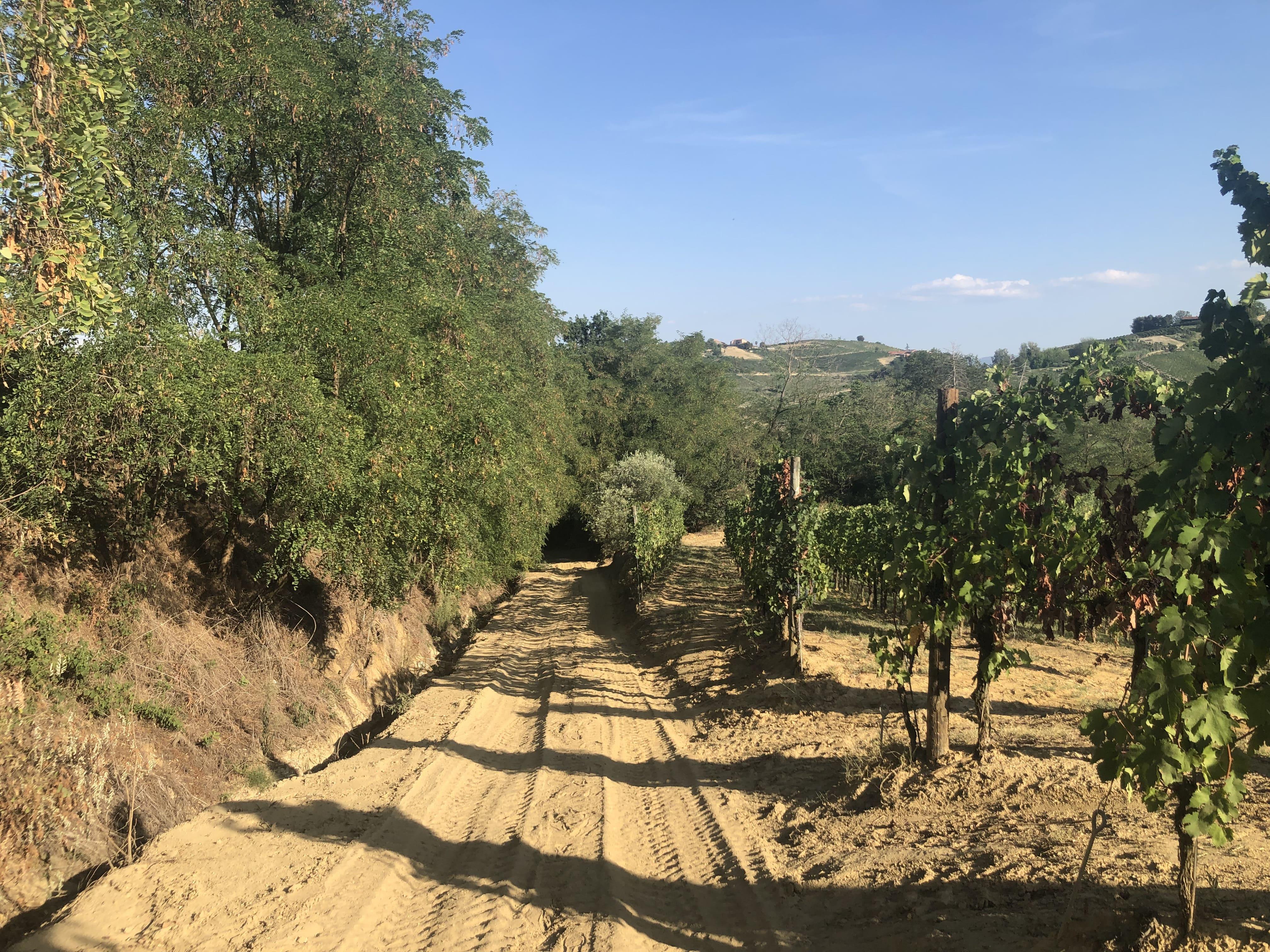
At the next crossroads, the bottom becomes arid and very sandy: here you turn right again, skirting a bank planted with vines that begins to climb gradually.
A little further on you reach an area planted with vines distinguished by the toponym Pescaja, where it seems there was a fountain of water popularly known as the "fountain of Barbarossa": here legend has it that the famous leader drank with his troops as he passed.
The passage of Barbarossa is linked to a foundation legend of the ancient parish church dedicated to Saints Gervasio and Protasio, which rises outside the town: thanks to the intervention of the two patron saints of the town, the oblique canes that characterized the ancient armor of the vineyards they were interpreted by Barbarossa's army as the spears of soldiers, ready to oppose the invasion, and so the leader decided to pass on, avoiding the clash.
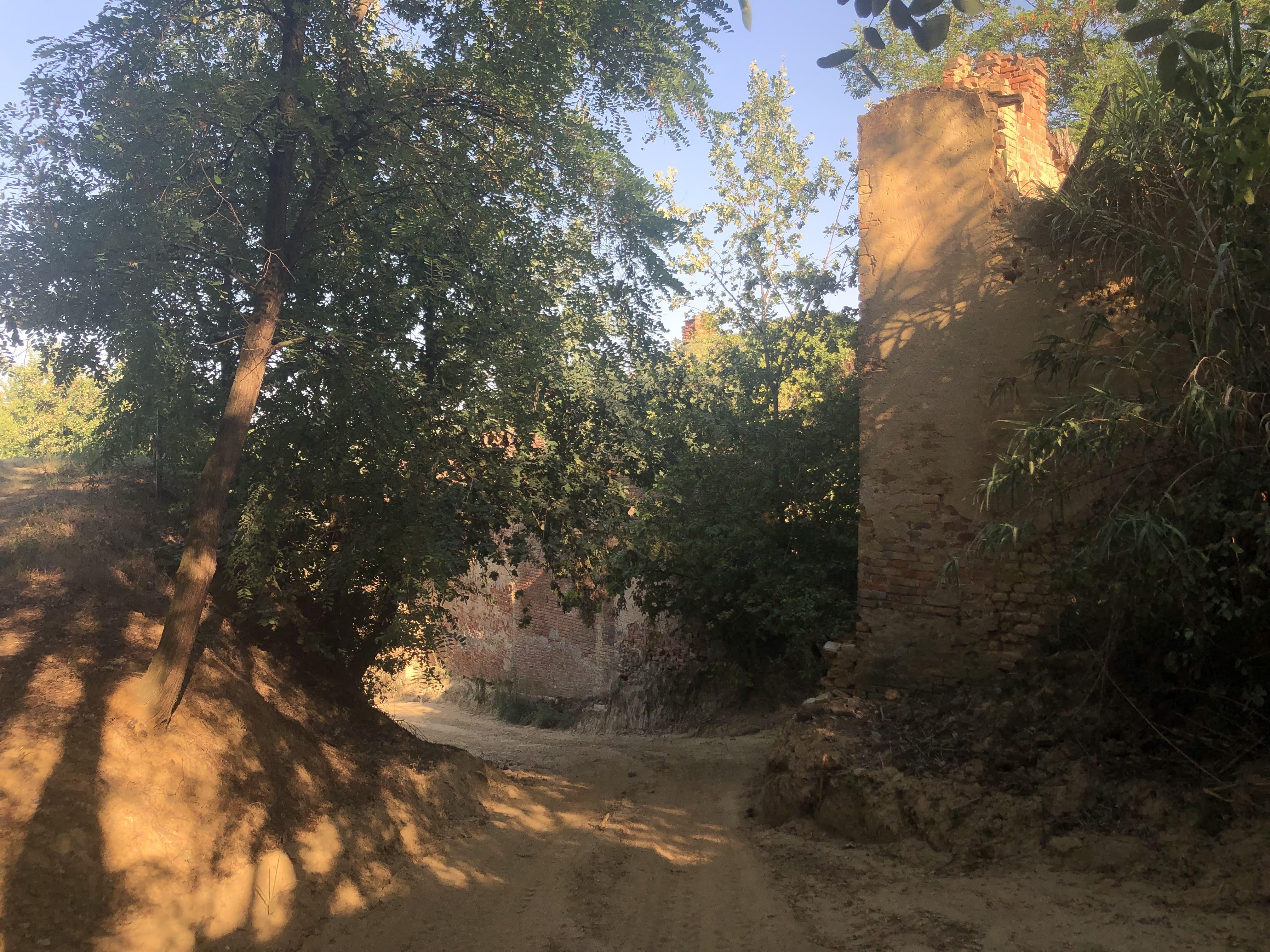
After the spring, you cross some old ruined farmhouses, and continue to climb for about 1 km in the direction of the village, along the path immersed in the vineyards and gaining a stretch on the ridge, between ordered rows that are well suited to the land of origin alluvial of this secluded valley, and from which Nebbiolo, Barbera, Arneis or Croatina grapes are produced.
The latter is a particularly ancient red grape variety, so much so that in some vineyards there are still visible strains of croatina ungrafted (that is, not grafted) of almost one hundred years; the symbol of the country, Cisterna d'Asti D.O.C., is obtained from Croatian grapes, vinified alone or at 80%, or Cisterna d'Asti Superiore if aged at least 10 months.
In the last part of the climb, the Sentiero dei Gelsi becomes paved and you reach the last group of houses in Cisterna d'Asti, which overlook the panoramic Via Lame.
Once you reach the small square adjacent to the Chapel of Saints Rocco, Pietro and Grato, walk along Via Lame for about one km which then becomes Via Italia and crosses the entire historic center of the town lying on the long ridge ridge, closing the loop in p .za Rino Rossino.
A very short detour is recommended to reach Piazza Maggiore Hope and the medieval castle of Cisterna on top of the town, enjoying the breathtaking panoramic view of its internal garden or visiting the Museum of Ancient Arts and Crafts inside.
WARNINGS
It is one of the 2 thematic circular trails in Cisterna d'Asti. All the Paths are staked and have a direction of travel: it is recommended to walk the Paths in the direction of travel indicated by the signs and in the maps; it is possible to extend the itinerary by crossing the other paths present.
Some stretches of the trail are demanding and technical for mountain biking. In some sections it is necessary to push the bicycle.
It is always recommended to have the map or GPX track, to wear shoes suitable for excursions on uneven surfaces, possibly a stick or hiking poles. In the spring / summer period it is advisable to bring drinking water and an energy bar in your backpack.
Never rely solely on local water supplies.
It is advisable, before leaving, to consult the weather forecast in advance and contact the Ecomuseum website or our offices to make sure that the Paths are actually practicable.
For people allergic to insect bites, pollen, dust or other, it is recommended to obtain the necessary medicines to deal with any unexpected stings or inhalations.
Before setting off on a path, it is recommended to inform someone of your destination or the path traveled, in order to allow, if necessary, to be reached more easily and to optimize any rescue operations.
The Ecomuseum is relieved of any responsibility for damages, injuries and losses to the users of the Paths.