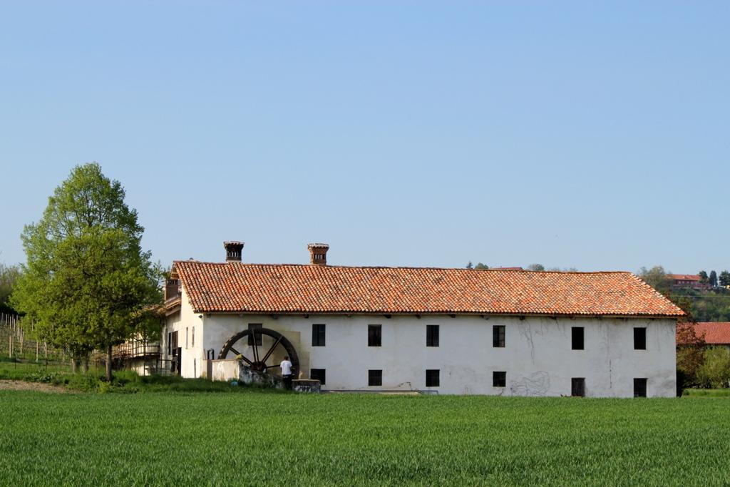
A path that leads from Magliano Alfieri to Guarene following the old plain road near the Tanaro river and its channels, where there was a lot of popular mills. The historical mills, nowadays not used, are a valid evidence of the agricultural identity and of the cereal vocation of this fertile plain portion. The Path coincides for a long part with the S3 Path, the signals of which can be also followed,and it is particularly suitable for MTB use.
ITINERARY
Not well-marked path. Map or GPX track needed.
WARNINGS
Not well-marked path. Map or GPX track needed.
The Roero trail network is planned to discover the paths by your own.
The trails are signposted with arrows and illustrative boards, in order to walk in the proper direction and in safety.
Please consider your physical abilities before starting a walk.
We recommend to provide you the map of the trail you are going to walk, to equip you with hiking shoes suitable for dirt and, eventually, with trekking poles.
In spring/summer is better to have water with you and some energizing food.
Please consult meteorological websites before leaving, and contact the Ecomuseum office or visite our website to verify the trails conditions.
For people allergic to insects bites or pollens is advised to have with you medicinal products to prevent inhalings or bites.
Before leaving, tell someone your destination or the trail you want to walk, in order to simplify first aid assistance in case of necessity.